
For my spatial
analysis class, one
of the many projects
we were tasked to
do was to observe
landfill locations
around the George
Washington
Planning District
(GWPD) and see the
environmental
impacts and zoning
regulations each
follows (Figure 1).
By doing this, we
were able to
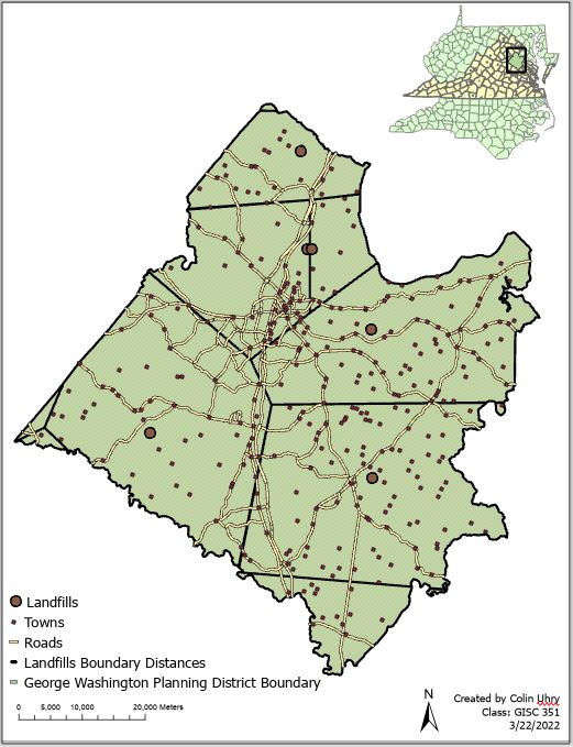
determine how close each town was in relation to certain
landfills, as shown in Figure 2.
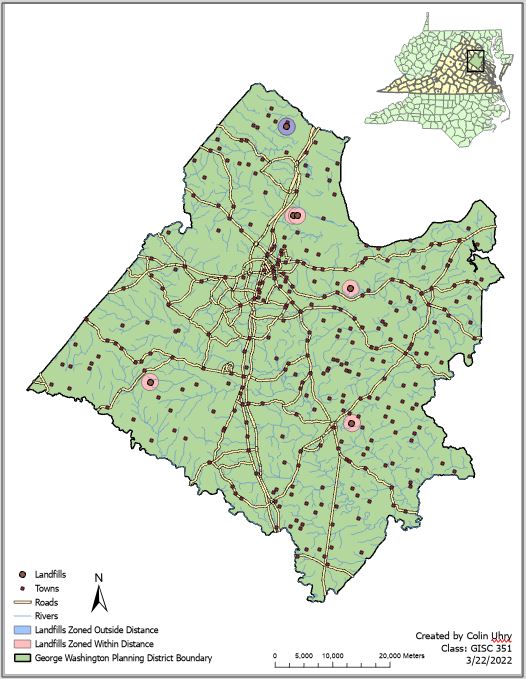
By starting out with a base map consisting of shapefiles
comprising of Virginia, West Virginia, Maryland, Washington D.C.,
and North Carolina, we first had to locate the GWPD and make its
own layer. After clipping the roads, landfill locations, towns, and
rivers to only include what is within the GWPD, we then had to
establish a buffer around the landfill dataset, making one color
(red) show which locations are within 1500 meters of a river and
Figure 1: Landfill Zoning Locations Based off Distance to Roads and Rivers
2000 meters of a main road while making another color (purple)
show which are zoned far enough away. As you can see by the
layout above, only one landfill, the Quantico landfill, is properly
zoned far enough away to cause minimal impact to the
surrounding rivers.
Upon completing this process, our next prompt was to
observe which landfill was closest to whichever town you were
in at the GWPD. After
creating Thiessen polygons,
one is able to see that the
entire GWPD can be divided
into seven subsections,
with the closest landfill
location being in the district
for six of them.

Leave a comment