Anyone who knows anything about the field of urban planning can tell you one certain fact; as the field of GIS has become more and more necessary to everyday life, it has slowly become more useful in the planning field. One major aspect about urban planning is showing how different zonings around areas lead to changes in city structures, a fact that can be demonstrated through census retrievals in GIS.
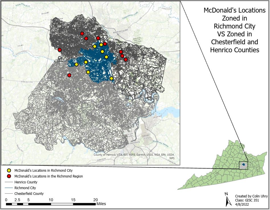
For my spatial analysis class, one of the last major labs we were tasked to do was create a locator and see which McDonald’s locations were actually zoned inside the city of Richmond vs which were zoned in the bordering counties, all while saying they were in Richmond for the publicity. As shown in Figure 1, there were 17 McDonald’s locations in the area of interest, with all of them saying they were in

the city but only 8 being in the actual zoning district. This showed that although there were many McDonald’s locations in the area, odds are that if you lived in Chesterfield or Henrico counties, the McDonald’s closest to you would say it’s a part of Richmond to drive tourism to the area.
McDonald’s is the most popular fast food chain in the United States and having its business be in close quarters with the city center is important, as that drives tourists to sightsee and take in the local culture without feeling too shell shocked at new experiences. By having multiple locations of McDonald’s outside Richmond say they’re either a part of the city or within driving distance of the city-center, it allows for more people to visit, driving up the city’s economy through tourism and advertising.

Leave a comment