
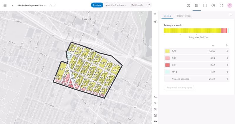
To model one of the pillars of a smart city strategy, planning and engineering, it is possible to use ArcGIS Urban to model the impact of future plans in order to create better decisions regarding the physical structure of our cities.
Looking at Newark, New Jersey, a city that notoriously has high rent prices with low salaries, I was able to create models and metrics that represent a clean, organized, and technical way for planners and engineers to lay out their future development pipeline and proposes plans. Additionally, these sharing tools allow city and county officials to control viewing privileges for proposed plans and projects. These tools are valuable in visualizing and quantifying proposed change in a community.
There are many things that could be done to further improve this step of the SMART city strategy, but the work done gives a good baseline into how using ArcGIS Urban to imagine different scenarios can impact a city. One factor that could be done is consider more variables into what can transform a regular city into a SMART City, such as the areas current demographics, the city’s financial ability to make big redevelopment changes, and how different levels of preexisting infrastructure can impact the city, as Henry mentioned earlier in this presentation, the Riverbank Park location would be the perfect spot for affordable housing, but not every city will have the perfect set of conditions in already being zoned for redevelopment, so it’s also important to consider the locations where major change needs to happen to provide a more comprehensive idea towards what can help create affordable housing scenarios in planning.

Leave a comment